


Cluny

raygautier
User
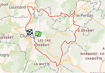

Length
21 km

Max alt
553 m

Uphill gradient
524 m
Km-Effort
28 km

Min alt
224 m

Downhill gradient
530 m
Boucle
Yes
Creation date :
2022-11-11 08:19:28.0
Updated on :
2022-11-12 08:52:56.2
4h23
Difficulty : Very difficult

FREE GPS app for hiking
 SityTrail
IGN / Geographical institutes
SityTrail Plus
The world is yours!
About
Trail Walking of 21 km to be discovered at Bourgogne-Franche-Comté, Saône-et-Loire, Cluny. This trail is proposed by raygautier.
Positioning
Country:
France
Region :
Bourgogne-Franche-Comté
Department/Province :
Saône-et-Loire
Municipality :
Cluny
Location:
Unknown
Start:(Dec)
Start:(UTM)
628136 ; 5143167 (31T) N.
Comments