


Pourcheres 14km

thonyc
User GUIDE
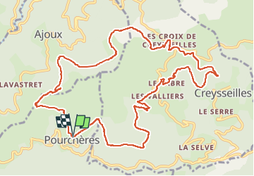

Length
14.1 km

Max alt
866 m

Uphill gradient
505 m
Km-Effort
21 km

Min alt
598 m

Downhill gradient
508 m
Boucle
Yes
Creation date :
2022-11-12 09:51:48.364
Updated on :
2022-11-15 08:08:38.652
4h00
Difficulty : Medium

FREE GPS app for hiking
 SityTrail
IGN / Geographical institutes
SityTrail Plus
The world is yours!
About
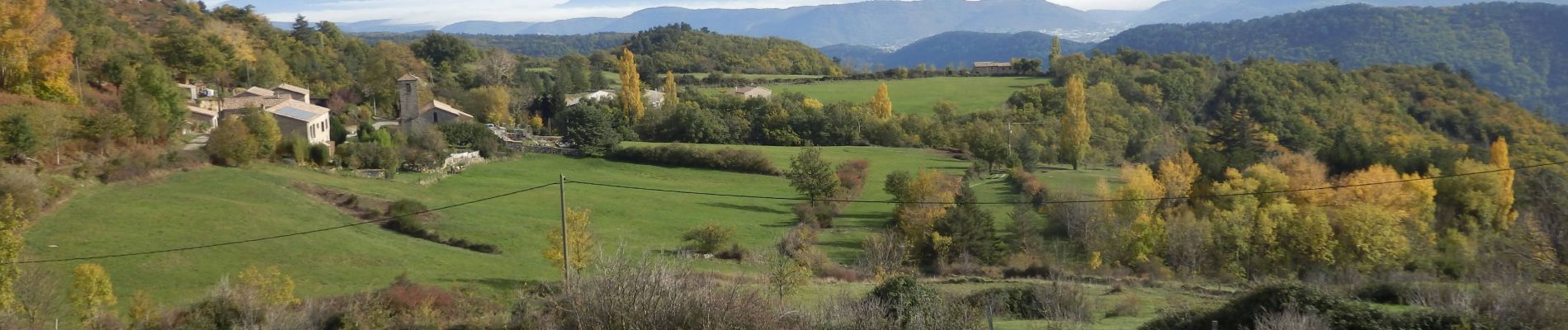
Trail Walking of 14.1 km to be discovered at Auvergne-Rhône-Alpes, Ardèche, Pourchères. This trail is proposed by thonyc.
Photos


Positioning
Country:
France
Region :
Auvergne-Rhône-Alpes
Department/Province :
Ardèche
Municipality :
Pourchères
Location:
Unknown
Start:(Dec)
Start:(UTM)
619249 ; 4955963 (31T) N.
Comments