Trail Walking Saint-Bruno-de-Montarville - St-Bruno - Photo
© OpenStreetMap contributors
Length
Length
8.7 km
Max alt
Max alt
152 m
Uphill gradient
Uphill gradient
139 m
Km-Effort
Km-Effort  
10.5 km
Min alt
Min alt
54 m
Downhill gradient
Downhill gradient
135 m
Boucle
Boucle
Yes
Creation date :
2022-11-12 14:08:53.232
Updated on :
2022-11-12 21:28:27.359

(0 Reviews)

Walking
Walking
3h33
Difficulty : Medium

Scan this QR Code to open this trail in the SityTrail application

FREE GPS app for hiking

Logo SityTrail SityTrail

IGN / Geographical institutes

Download SityTrail from the App Store Download SityTrail from Google Play

Logo SityTrail SityTrail World

The world is yours!

Download SityTrail from the App Store Download SityTrail from Google Play Download SityTrail on Huawei AppGallery

About

Trail Walking of 8.7 km to be discovered at Quebec, Longueuil (agglomeration), Saint-Bruno-de-Montarville. This trail is proposed by Denis Muzungu.

Elevation profile

Positioning

Country:
Canada
Region :
Quebec
Department/Province :
Longueuil (agglomeration)
Municipality :
Saint-Bruno-de-Montarville
Location:
Unknown
Start:(UTM)
629336 ; 5045046 (18T) N.

Trails nearby

Trail Walking Saint-Bruno-de-Montarville - Wikiloc - Montérégie - Parc national du Mont-Saint-Bruno - Sentiers de... - Photo
Walking
GUIDE
Alizée.pee

Walking

Easy
(1)
Saint-Bruno-de-Montarville, Quebec, Longueuil (agglomeration), Canada
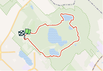
8.8 km | 10.7 km-effort
2h 19min
Yes


Close
My subscriptions