


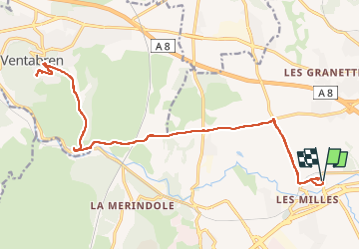
ventabren route

jefflesmilles
User

Length
26 km

Max alt
256 m

Uphill gradient
381 m
Km-Effort
31 km

Min alt
90 m

Downhill gradient
381 m
Boucle
Yes
Creation date :
2022-11-13 08:28:51.936
Updated on :
2022-11-13 09:58:42.309
1h29
Difficulty : Easy

FREE GPS app for hiking
 SityTrail
IGN / Geographical institutes
SityTrail Plus
The world is yours!
About
Trail Road bike of 26 km to be discovered at Provence-Alpes-Côte d'Azur, Bouches-du-Rhône, Aix-en-Provence. This trail is proposed by jefflesmilles.
Positioning
Country:
France
Region :
Provence-Alpes-Côte d'Azur
Department/Province :
Bouches-du-Rhône
Municipality :
Aix-en-Provence
Location:
Unknown
Start:(Dec)
Start:(UTM)
693407 ; 4820069 (31T) N.
Comments