


Tour de Crahay

AnneCecile
User
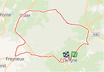

Length
10.3 km

Max alt
588 m

Uphill gradient
227 m
Km-Effort
13.3 km

Min alt
403 m

Downhill gradient
228 m
Boucle
Yes
Creation date :
2022-11-13 09:12:00.0
Updated on :
2022-11-13 13:43:08.938
2h55
Difficulty : Difficult

FREE GPS app for hiking
 SityTrail
IGN / Geographical institutes
SityTrail Plus
The world is yours!
About
Trail Walking of 10.3 km to be discovered at Wallonia, Luxembourg, Manhay. This trail is proposed by AnneCecile.
Description
Balisage croix verte un peu modifiée.
Un peu trop de route.
Positioning
Country:
Belgium
Region :
Wallonia
Department/Province :
Luxembourg
Municipality :
Manhay
Location:
Unknown
Start:(Dec)
Start:(UTM)
691288 ; 5570543 (31U) N.
Comments