


chapelle St Quinis

FSantoni
User

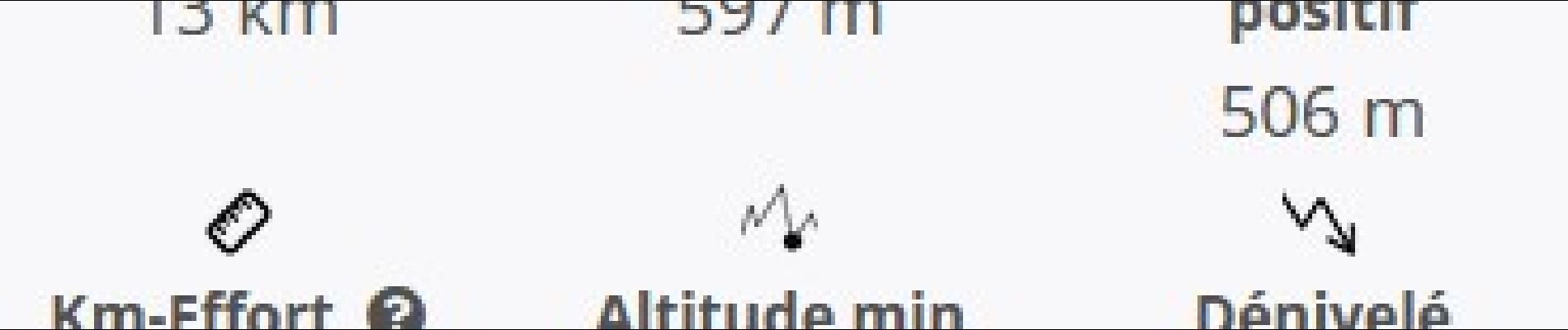
Length
13.5 km

Max alt
597 m

Uphill gradient
506 m
Km-Effort
20 km

Min alt
275 m

Downhill gradient
506 m
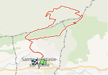
Boucle
Yes
Creation date :
2022-11-13 08:06:49.605
Updated on :
2022-11-13 17:43:26.857
5h55
Difficulty : Difficult

FREE GPS app for hiking
 SityTrail
IGN / Geographical institutes
SityTrail Plus
The world is yours!
About
Trail Walking of 13.5 km to be discovered at Provence-Alpes-Côte d'Azur, Var, Sainte-Anastasie-sur-Issole. This trail is proposed by FSantoni.
Description
Belle balade, avec de magnifiques paysages automnaux.
Dénivelé solide, vue magnifique du sommet et chapelle en trés bel état.
Photos


Positioning
Country:
France
Region :
Provence-Alpes-Côte d'Azur
Department/Province :
Var
Municipality :
Sainte-Anastasie-sur-Issole
Location:
Unknown
Start:(Dec)
Start:(UTM)
266973 ; 4802516 (32T) N.
Comments