


bellecombe / refuge de la femma

natsukeru
User

Length
11.1 km

Max alt
2421 m

Uphill gradient
333 m
Km-Effort
15.4 km

Min alt
2194 m

Downhill gradient
288 m
Boucle
No
Creation date :
2022-09-18 12:46:56.238
Updated on :
2022-11-13 15:16:03.897
2h39
Difficulty : Medium

FREE GPS app for hiking
 SityTrail
IGN / Geographical institutes
SityTrail Plus
The world is yours!
About
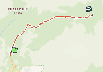
Trail Walking of 11.1 km to be discovered at Auvergne-Rhône-Alpes, Savoy, Val-Cenis. This trail is proposed by natsukeru.
Positioning
Country:
France
Region :
Auvergne-Rhône-Alpes
Department/Province :
Savoy
Municipality :
Val-Cenis
Location:
Termignon
Start:(Dec)
Start:(UTM)
329936 ; 5021710 (32T) N.
Comments