


Amicale_Lozanne_Chazay

d.rognon
User

Length
8.9 km

Max alt
227 m

Uphill gradient
90 m
Km-Effort
10.1 km

Min alt
187 m

Downhill gradient
90 m
Boucle
Yes
Creation date :
2022-11-20 09:57:10.062
Updated on :
2023-03-25 15:41:32.161
2h17
Difficulty : Medium

FREE GPS app for hiking
 SityTrail
IGN / Geographical institutes
SityTrail Plus
The world is yours!
About
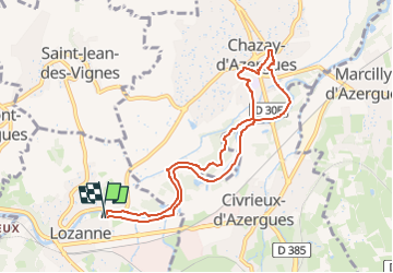
Trail Walking of 8.9 km to be discovered at Auvergne-Rhône-Alpes, Rhône, Lozanne. This trail is proposed by d.rognon.
Description
Randonnée faite le 21 février 2023
Positioning
Country:
France
Region :
Auvergne-Rhône-Alpes
Department/Province :
Rhône
Municipality :
Lozanne
Location:
Unknown
Start:(Dec)
Start:(UTM)
630958 ; 5079662 (31T) N.
Comments