


rando canal

peuch4
User

Length
21 km

Max alt
114 m

Uphill gradient
218 m
Km-Effort
24 km

Min alt
37 m

Downhill gradient
218 m
Boucle
Yes
Creation date :
2022-11-20 08:55:10.896
Updated on :
2022-11-20 12:27:47.906
3h25
Difficulty : Easy

FREE GPS app for hiking
 SityTrail
IGN / Geographical institutes
SityTrail Plus
The world is yours!
About
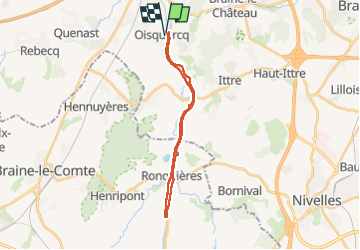
Trail Walking of 21 km to be discovered at Wallonia, Walloon Brabant, Tubize. This trail is proposed by peuch4.
Description
Canal charleroi Bruxelles.
De oisquercq à ronquieres
Positioning
Country:
Belgium
Region :
Wallonia
Department/Province :
Walloon Brabant
Municipality :
Tubize
Location:
Oisquercq
Start:(Dec)
Start:(UTM)
586197 ; 5613820 (31U) N.
Comments