


Parnes Est la cote des noyers

serge.guerroult
User
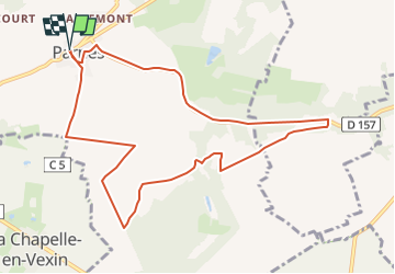

Length
9.8 km

Max alt
143 m

Uphill gradient
126 m
Km-Effort
11.5 km

Min alt
76 m

Downhill gradient
126 m
Boucle
Yes
Creation date :
2022-11-25 19:16:00.901
Updated on :
2022-11-26 12:37:59.692
0m
Difficulty : Very easy

FREE GPS app for hiking
 SityTrail
IGN / Geographical institutes
SityTrail Plus
The world is yours!
About
Trail Nordic walking of 9.8 km to be discovered at Hauts-de-France, Oise, Parnes. This trail is proposed by serge.guerroult.
Positioning
Country:
France
Region :
Hauts-de-France
Department/Province :
Oise
Municipality :
Parnes
Location:
Unknown
Start:(Dec)
Start:(UTM)
408056 ; 5450876 (31U) N.
Comments