


Igny

c.chehere
User
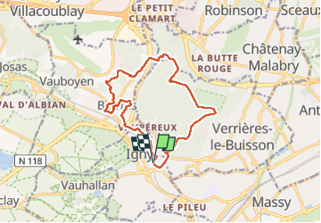

Length
13.8 km

Max alt
181 m

Uphill gradient
245 m
Km-Effort
17.1 km

Min alt
63 m

Downhill gradient
243 m
Boucle
Yes
Creation date :
2022-11-29 07:32:33.557
Updated on :
2022-11-29 12:12:20.024
3h32
Difficulty : Easy

FREE GPS app for hiking
 SityTrail
IGN / Geographical institutes
SityTrail Plus
The world is yours!
About
Trail Walking of 13.8 km to be discovered at Ile-de-France, Essonne, Igny. This trail is proposed by c.chehere.
Photos


Positioning
Country:
France
Region :
Ile-de-France
Department/Province :
Essonne
Municipality :
Igny
Location:
Unknown
Start:(Dec)
Start:(UTM)
443482 ; 5398858 (31U) N.
Comments