


pic pelé
© OpenStreetMap contributors


2h53
Difficulty : Medium


Length
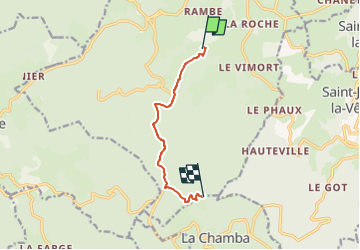
6.8 km
Max alt
1347 m
Uphill gradient
587 m
Km-Effort
12.7 km
Min alt
756 m
Downhill gradient
9 m
Boucle
No
Creation date :
2022-12-04 14:33:05.611
Updated on :
2022-12-04 14:33:06.936
2h53
Difficulty : Medium
FREE GPS app for hiking
 SityTrail
IGN / Geographical institutes
SityTrail Plus
The world is yours!
About
Trail Walking of 6.8 km to be discovered at Auvergne-Rhône-Alpes, Loire, Noirétable. This trail is proposed by louventouletdu04@hotmail.fr.
Positioning
Country:
France
Region :
Auvergne-Rhône-Alpes
Department/Province :
Loire
Municipality :
Noirétable
Location:
Unknown
Start:(Dec)
Start:(UTM)
558535 ; 5072213 (31T) N.
Comments