


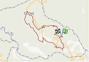
ND de Roure / Taillet

robertperello
User

Length
11.2 km

Max alt
645 m

Uphill gradient
339 m
Km-Effort
15.8 km

Min alt
380 m

Downhill gradient
345 m
Boucle
Yes
Creation date :
2022-12-07 08:04:04.0
Updated on :
2022-12-07 14:04:14.402
3h02
Difficulty : Easy

FREE GPS app for hiking
 SityTrail
IGN / Geographical institutes
SityTrail Plus
The world is yours!
About
Trail Walking of 11.2 km to be discovered at Occitania, Pyrénées-Orientales, Taillet. This trail is proposed by robertperello.
Description
Rando facile
Photos


Positioning
Country:
France
Region :
Occitania
Department/Province :
Pyrénées-Orientales
Municipality :
Taillet
Location:
Unknown
Start:(Dec)
Start:(UTM)
474959 ; 4706913 (31T) N.
Comments