


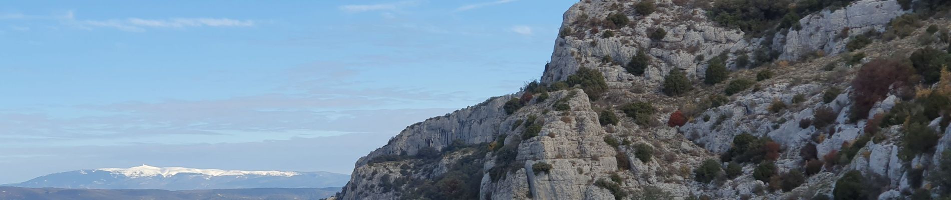
Les Crêtes du Colombier

MarcLEBARON
User
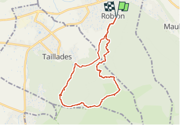

Length
9.2 km

Max alt
462 m

Uphill gradient
474 m
Km-Effort
15.6 km

Min alt
129 m

Downhill gradient
474 m
Boucle
Yes
Creation date :
2022-12-08 08:27:07.397
Updated on :
2023-02-09 14:47:01.3
3h28
Difficulty : Medium

FREE GPS app for hiking
 SityTrail
IGN / Geographical institutes
SityTrail Plus
The world is yours!
About
Trail Walking of 9.2 km to be discovered at Provence-Alpes-Côte d'Azur, Vaucluse, Robion. This trail is proposed by MarcLEBARON.
Photos


Positioning
Country:
France
Region :
Provence-Alpes-Côte d'Azur
Department/Province :
Vaucluse
Municipality :
Robion
Location:
Unknown
Start:(Dec)
Start:(UTM)
669909 ; 4856678 (31T) N.
Comments