Trail Walking L'Église-aux-Bois - Lacelle Treignac - Photo
© OpenStreetMap contributors
Length
Length
17.9 km
Max alt
Max alt
739 m
Uphill gradient
Uphill gradient
328 m
Km-Effort
Km-Effort  
23 km
Min alt
Min alt
454 m
Downhill gradient
Downhill gradient
504 m
Boucle
Boucle
No
Creation date :
2014-12-10 00:00:00.0
Updated on :
2014-12-10 00:00:00.0

(0 Reviews)

Walking
Walking
5h58
Difficulty : Easy

Scan this QR Code to open this trail in the SityTrail application

FREE GPS app for hiking

Logo SityTrail SityTrail

IGN / Geographical institutes

Download SityTrail from the App Store Download SityTrail from Google Play

Logo SityTrail SityTrail World

The world is yours!

Download SityTrail from the App Store Download SityTrail from Google Play Download SityTrail on Huawei AppGallery

About

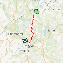
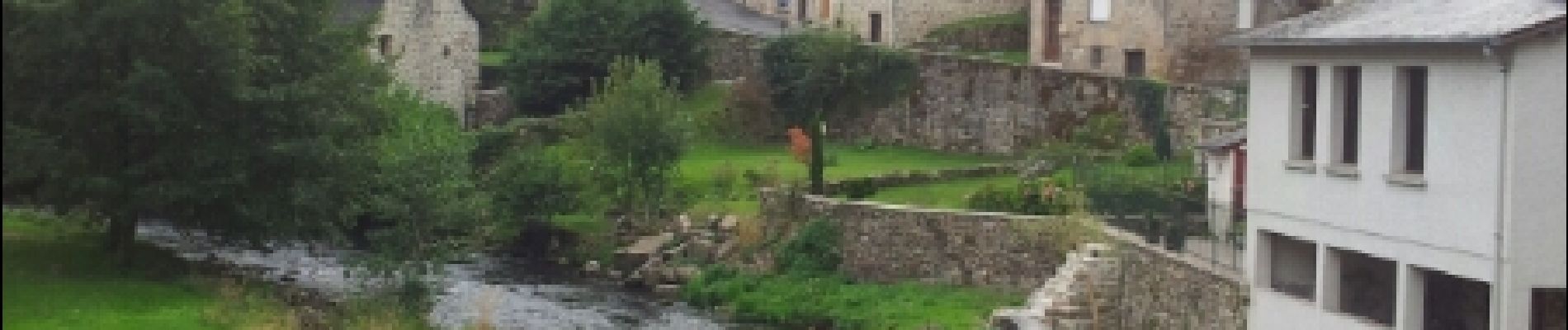
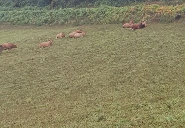
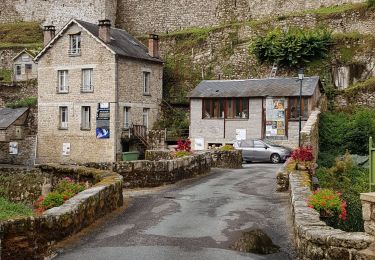
Trail Walking of 17.9 km to be discovered at New Aquitaine, Corrèze, L'Église-aux-Bois. This trail is proposed by Jamartrita.

Description

Sainr Jacques

Elevation profile

Photos

Positioning

Country:
France
Region :
New Aquitaine
Department/Province :
Corrèze
Municipality :
L'Église-aux-Bois
Location:
Unknown
Start:(UTM)
408070 ; 5055706 (31T) N.

Trails nearby

Trail Running Lacelle - Jour 18 CAP Jeanot - Photo
Running
jeannat

Running

Very easy
Lacelle, New Aquitaine, Corrèze, France
33 km | 43 km-effort
3h 51min
No
Trail Running Lacelle - Jour 18 CAP Jeanot - Photo
Running
jeannat

Running

Very easy
Lacelle, New Aquitaine, Corrèze, France
33 km | 43 km-effort
3h 51min
No
Trail Walking Viam - [Itinéraire] Le Tour du Lac de Viam - Photo
Walking
houbart

Walking

Difficult
(1)
Viam, New Aquitaine, Corrèze, France
14.4 km | 18.5 km-effort
4h 12min
Yes
Trail Walking Lacelle - La Celle - Photo
Walking
martinjacque

Walking

Easy
Lacelle, New Aquitaine, Corrèze, France
7.1 km | 9.7 km-effort
2h 38min
Yes
Trail Hybrid bike Lacelle - jour 18 - Photo
Hybrid bike
nathbab

Hybrid bike

Very easy
Lacelle, New Aquitaine, Corrèze, France
36 km | 44 km-effort
1h 54min
No
Trail Walking Rempnat - GR46-04 - La Villeneuve - Treignac - Photo
Walking
Tournan

Walking

Medium
Rempnat, New Aquitaine, Haute-Vienne, France
23 km | 31 km-effort
6h 26min
No


Close
My subscriptions