


Nans sous sainte Anne Autour de la source du Lison

grasgilbert
User
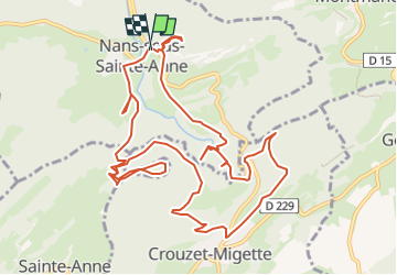

Length
13.5 km

Max alt
692 m

Uphill gradient
700 m
Km-Effort
23 km

Min alt
361 m

Downhill gradient
695 m
Boucle
Yes
Creation date :
2022-12-13 13:39:45.67
Updated on :
2022-12-13 14:28:29.844
4h17
Difficulty : Difficult

FREE GPS app for hiking
 SityTrail
IGN / Geographical institutes
SityTrail Plus
The world is yours!
About
Trail Walking of 13.5 km to be discovered at Bourgogne-Franche-Comté, Doubs, Nans-sous-Sainte-Anne. This trail is proposed by grasgilbert.
Description
cascade du Verneau
Positioning
Country:
France
Region :
Bourgogne-Franche-Comté
Department/Province :
Doubs
Municipality :
Nans-sous-Sainte-Anne
Location:
Unknown
Start:(Dec)
Start:(UTM)
271838 ; 5207049 (32T) N.
Comments