


Tellin MHL 2022

fra_depoorter
User
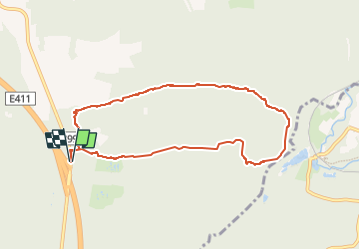

Length
7.9 km

Max alt
425 m

Uphill gradient
156 m
Km-Effort
9.9 km

Min alt
305 m

Downhill gradient
158 m
Boucle
Yes
Creation date :
2022-12-15 12:59:53.782
Updated on :
2022-12-16 09:15:28.441
2h26
Difficulty : Easy

FREE GPS app for hiking
 SityTrail
IGN / Geographical institutes
SityTrail Plus
The world is yours!
About
Trail Walking of 7.9 km to be discovered at Wallonia, Luxembourg, Tellin. This trail is proposed by fra_depoorter.
Positioning
Country:
Belgium
Region :
Wallonia
Department/Province :
Luxembourg
Municipality :
Tellin
Location:
Unknown
Start:(Dec)
Start:(UTM)
658262 ; 5546890 (31U) N.
Comments