


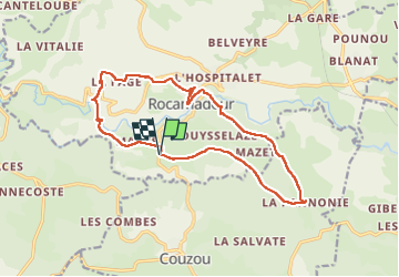
Col de mages Lafage Rocamadour La Panonie

antignacs
User GUIDE

Length
16.6 km

Max alt
310 m

Uphill gradient
390 m
Km-Effort
22 km

Min alt
126 m

Downhill gradient
390 m
Boucle
Yes
Creation date :
2022-12-19 09:48:08.0
Updated on :
2022-12-19 14:17:09.839
3h57
Difficulty : Easy

FREE GPS app for hiking
 SityTrail
IGN / Geographical institutes
SityTrail Plus
The world is yours!
About
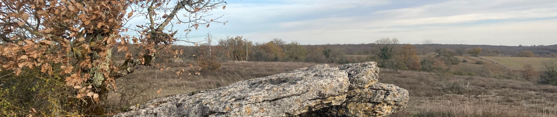
Trail Walking of 16.6 km to be discovered at Occitania, Lot, Rocamadour. This trail is proposed by antignacs.
Photos


Positioning
Country:
France
Region :
Occitania
Department/Province :
Lot
Municipality :
Rocamadour
Location:
Unknown
Start:(Dec)
Start:(UTM)
389952 ; 4960357 (31T) N.
Comments
