


bergères 2014

Tollard
User
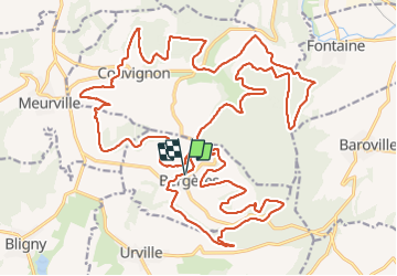

Length
37 km

Max alt
367 m

Uphill gradient
784 m
Km-Effort
48 km

Min alt
205 m

Downhill gradient
782 m
Boucle
Yes
Creation date :
2014-12-10 00:00:00.0
Updated on :
2014-12-10 00:00:00.0
3h04
Difficulty : Medium

FREE GPS app for hiking
 SityTrail
IGN / Geographical institutes
SityTrail Plus
The world is yours!
About
Trail Mountain bike of 37 km to be discovered at Grand Est, Aube, Bergères. This trail is proposed by Tollard.
Positioning
Country:
France
Region :
Grand Est
Department/Province :
Aube
Municipality :
Bergères
Location:
Unknown
Start:(Dec)
Start:(UTM)
623907 ; 5338345 (31U) N.
Comments
le top 10
bravo au Randorient le TOP