


Rando des Brasseurs 2014

PhilippeC54
User

Length
39 km

Max alt
425 m

Uphill gradient
803 m
Km-Effort
49 km

Min alt
260 m

Downhill gradient
812 m
Boucle
Yes
Creation date :
2014-12-10 00:00:00.0
Updated on :
2014-12-10 00:00:00.0
3h11
Difficulty : Medium

FREE GPS app for hiking
 SityTrail
IGN / Geographical institutes
SityTrail Plus
The world is yours!
About
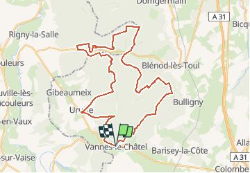
Trail Mountain bike of 39 km to be discovered at Grand Est, Meurthe-et-Moselle, Vannes-le-Châtel. This trail is proposed by PhilippeC54.
Description
39 Km
Positioning
Country:
France
Region :
Grand Est
Department/Province :
Meurthe-et-Moselle
Municipality :
Vannes-le-Châtel
Location:
Unknown
Start:(Dec)
Start:(UTM)
705171 ; 5380810 (31U) N.
Comments