


Riom les vignes de Ronchalon modifiées

jeanic63
User
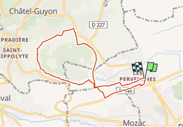

Length
8.6 km

Max alt
474 m

Uphill gradient
160 m
Km-Effort
10.7 km

Min alt
334 m

Downhill gradient
156 m
Boucle
Yes
Creation date :
2022-12-28 16:39:38.848
Updated on :
2022-12-28 16:50:46.185
2h27
Difficulty : Easy

FREE GPS app for hiking
 SityTrail
IGN / Geographical institutes
SityTrail Plus
The world is yours!
About
Trail On foot of 8.6 km to be discovered at Auvergne-Rhône-Alpes, Puy-de-Dôme, Riom. This trail is proposed by jeanic63.
Description
départ la chapelle saint Don
Positioning
Country:
France
Region :
Auvergne-Rhône-Alpes
Department/Province :
Puy-de-Dôme
Municipality :
Riom
Location:
Unknown
Start:(Dec)
Start:(UTM)
507681 ; 5083445 (31T) N.
Comments