


Randonnée du 01/08/2019 à 08:53

geranimo
User

Length
21 km

Max alt
741 m

Uphill gradient
743 m
Km-Effort
32 km

Min alt
277 m

Downhill gradient
921 m
Boucle
No
Creation date :
2022-12-31 17:36:14.325
Updated on :
2022-12-31 19:23:51.232
7h14
Difficulty : Difficult

FREE GPS app for hiking
 SityTrail
IGN / Geographical institutes
SityTrail Plus
The world is yours!
About
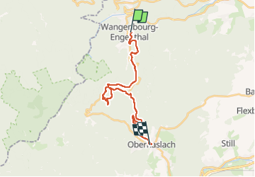
Trail Walking of 21 km to be discovered at Grand Est, Bas-Rhin, Wangenbourg-Engenthal. This trail is proposed by geranimo.
Positioning
Country:
France
Region :
Grand Est
Department/Province :
Bas-Rhin
Municipality :
Wangenbourg-Engenthal
Location:
Unknown
Start:(Dec)
Start:(UTM)
375416 ; 5386853 (32U) N.
Comments