


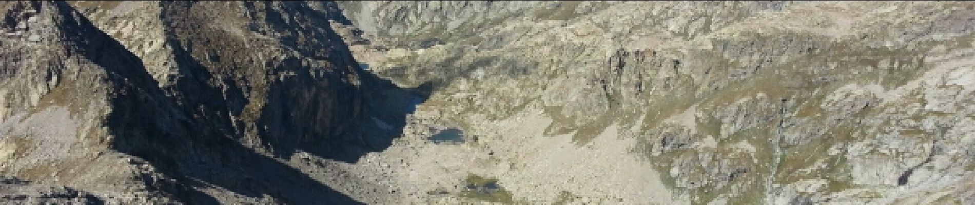
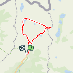
Refuge de Nice - baisse Basto - Lac Autier.

ch2slv
User

Length
14.1 km

Max alt
2734 m

Uphill gradient
1095 m
Km-Effort
29 km

Min alt
1684 m

Downhill gradient
1097 m
Boucle
Yes
Creation date :
2014-12-10 00:00:00.0
Updated on :
2014-12-10 00:00:00.0
5h38
Difficulty : Difficult

FREE GPS app for hiking
 SityTrail
IGN / Geographical institutes
SityTrail Plus
The world is yours!
About
Trail Walking of 14.1 km to be discovered at Provence-Alpes-Côte d'Azur, Maritime Alps, Belvédère. This trail is proposed by ch2slv.
Description
Boucle variée: cascade, lacs , alpages, beaux sommets.
Photos


Positioning
Country:
France
Region :
Provence-Alpes-Côte d'Azur
Department/Province :
Maritime Alps
Municipality :
Belvédère
Location:
Unknown
Start:(Dec)
Start:(UTM)
371954 ; 4881361 (32T) N.
Comments