


cirey frémonville blamont voie romaine tanconville cirey

Titinechris
User
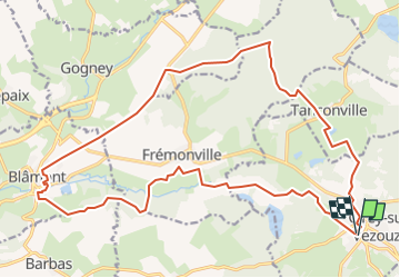

Length
23 km

Max alt
367 m

Uphill gradient
350 m
Km-Effort
27 km

Min alt
258 m

Downhill gradient
350 m
Boucle
Yes
Creation date :
2023-01-02 17:35:32.957
Updated on :
2023-01-02 17:42:46.807
0m
Difficulty : Easy

FREE GPS app for hiking
 SityTrail
IGN / Geographical institutes
SityTrail Plus
The world is yours!
About
Trail Running of 23 km to be discovered at Grand Est, Meurthe-et-Moselle, Cirey-sur-Vezouze. This trail is proposed by Titinechris.
Positioning
Country:
France
Region :
Grand Est
Department/Province :
Meurthe-et-Moselle
Municipality :
Cirey-sur-Vezouze
Location:
Unknown
Start:(Dec)
Start:(UTM)
348298 ; 5382739 (32U) N.
Comments