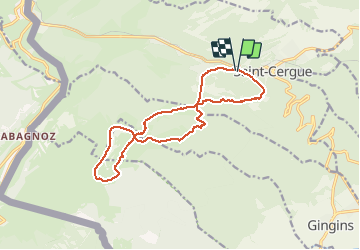
Saint-Cergue - La Dôle

micheldutilleul
User

Length
15 km

Max alt
1671 m

Uphill gradient
745 m
Km-Effort
25 km

Min alt
1093 m

Downhill gradient
745 m
Boucle
Yes
Creation date :
2015-07-22 00:00:00.0
Updated on :
2015-07-22 00:00:00.0
5h15
Difficulty : Difficult

FREE GPS app for hiking
 SityTrail
IGN / Geographical institutes
SityTrail Plus
The world is yours!
About
Trail Walking of 15 km to be discovered at Vaud, District de Nyon, Saint-Cergue. This trail is proposed by micheldutilleul.
Positioning
Country:
Switzerland
Region :
Vaud
Department/Province :
District de Nyon
Municipality :
Saint-Cergue
Location:
Unknown
Start:(Dec)
Start:(UTM)
280782 ; 5147545 (32T) N.
Comments