


ceyrestr cabanon du marquis

tessonnierg
User

Length
11.2 km

Max alt
518 m

Uphill gradient
434 m
Km-Effort
17 km

Min alt
122 m

Downhill gradient
436 m
Boucle
Yes
Creation date :
2023-01-12 08:30:14.054
Updated on :
2023-01-12 14:38:42.369
4h09
Difficulty : Difficult

FREE GPS app for hiking
 SityTrail
IGN / Geographical institutes
SityTrail Plus
The world is yours!
About
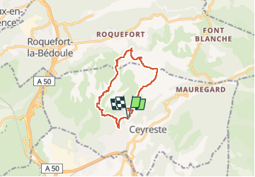
Trail Walking of 11.2 km to be discovered at Provence-Alpes-Côte d'Azur, Bouches-du-Rhône, Ceyreste. This trail is proposed by tessonnierg.
Positioning
Country:
France
Region :
Provence-Alpes-Côte d'Azur
Department/Province :
Bouches-du-Rhône
Municipality :
Ceyreste
Location:
Unknown
Start:(Dec)
Start:(UTM)
713592 ; 4788836 (31T) N.
Comments