


La canalisation des Orangers Roche Plate

ramagufa
User
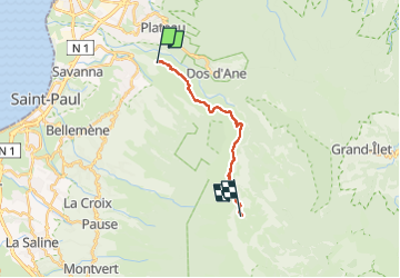

Length
17.4 km

Max alt
1344 m

Uphill gradient
1898 m
Km-Effort
41 km

Min alt
454 m

Downhill gradient
1257 m
Boucle
No
Creation date :
2023-01-12 17:13:26.215
Updated on :
2023-05-20 18:52:48.681
9h13
Difficulty : Very difficult

FREE GPS app for hiking
 SityTrail
IGN / Geographical institutes
SityTrail Plus
The world is yours!
About
Trail Walking of 17.4 km to be discovered at Réunion, Unknown, Saint-Paul. This trail is proposed by ramagufa.
Description
Rando en deux jours
premier jour canalisation des orangers vers Roche plate.
Deuxième jour, Roche plate Maïdo parla brèche
Positioning
Country:
France
Region :
Réunion
Department/Province :
Unknown
Municipality :
Saint-Paul
Location:
Unknown
Start:(Dec)
Start:(UTM)
328105 ; 7679161 (40K) S.
Comments