


bagnols en foret / pic de la gardiette /bayonne

Michel DUBOIS
User

Length
13.1 km

Max alt
418 m

Uphill gradient
348 m
Km-Effort
17.7 km

Min alt
246 m

Downhill gradient
349 m
Boucle
Yes
Creation date :
2023-01-13 17:48:57.231
Updated on :
2023-01-13 17:48:58.452
4h01
Difficulty : Medium

FREE GPS app for hiking
 SityTrail
IGN / Geographical institutes
SityTrail Plus
The world is yours!
About
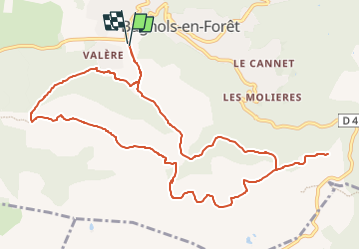
Trail Walking of 13.1 km to be discovered at Provence-Alpes-Côte d'Azur, Var, Bagnols-en-Forêt. This trail is proposed by Michel DUBOIS.
Positioning
Country:
France
Region :
Provence-Alpes-Côte d'Azur
Department/Province :
Var
Municipality :
Bagnols-en-Forêt
Location:
Unknown
Start:(Dec)
Start:(UTM)
313310 ; 4822844 (32T) N.
Comments