Trail Walking Vilvoorde - Walk Vilvoorde - Grimbergen II - Photo

Walk Vilvoorde - Grimbergen II

 Geert H.
Geert H.

User

© OpenStreetMap contributors
Length
Length
17.6 km
Max alt
Max alt
59 m
Uphill gradient
Uphill gradient
180 m
Km-Effort
Km-Effort  
20 km
Min alt
Min alt
7 m
Downhill gradient
Downhill gradient
179 m
Boucle
Boucle
Yes
Creation date :
2023-01-14 13:02:39.679
Updated on :
2023-04-09 07:45:36.991

(1 Reviews)

Walking
Walking
4h14
Difficulty : Easy

Scan this QR Code to open this trail in the SityTrail application

FREE GPS app for hiking

Logo SityTrail SityTrail

IGN / Geographical institutes

Download SityTrail from the App Store Download SityTrail from Google Play

Logo SityTrail SityTrail World

The world is yours!

Download SityTrail from the App Store Download SityTrail from Google Play Download SityTrail on Huawei AppGallery

About

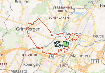
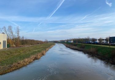
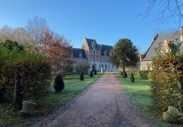
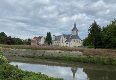
Trail Walking of 17.6 km to be discovered at Flanders, Flemish Brabant, Vilvoorde. This trail is proposed by Geert H..

Description

Wandeling voor de Patagonia groep

Elevation profile

Points of interest

Point of interest Vilvoorde - Park Drie Fonteinen - Photo
Geert H.
Point of interest Vilvoorde - Ijskelder - Photo
Geert H.
VILVOORDE 
Point of interest Vilvoorde - Salangaanbrug - Photo
Geert H.
VILVOORDE 
Point of interest Vilvoorde - Tuchthuis - Photo
Geert H.
VILVOORDE 
Point of interest Vilvoorde - Grote Markt - Photo
Geert H.
VILVOORDE 
Point of interest Grimbergen - Motte van Borgt - Photo
Geert H.
GRIMBERGEN 
Point of interest Grimbergen - Flood of 1839 - Photo
Geert H.
GRIMBERGEN 
Point of interest Grimbergen - Sint-Servaasbasiliek - Photo
Geert H.
Point of interest Grimbergen - Prinsenkasteel - Photo
Geert H.
GRIMBERGEN 
Point of interest Grimbergen - Tommenmolen - Photo
Geert H.
GRIMBERGEN 
Point of interest Grimbergen - Charleroyhoeve - Photo
Geert H.
GRIMBERGEN 
Point of interest Grimbergen - Liermolen - Photo
Geert H.
GRIMBERGEN 
Point of interest Vilvoorde - Japanse tuin - Photo
Geert H.
VILVOORDE 

Positioning

Country:
Belgium
Region :
Flanders
Department/Province :
Flemish Brabant
Municipality :
Vilvoorde
Location:
Vilvoorde
Start:(UTM)
599212 ; 5641474 (31U) N.

Comments

Please log in to post a review or rate the element


Trails nearby

Trail Walking Steenokkerzeel - Steenokkerzeel  - Photo
Walking
GUIDE
mumu.larandonneuse

Walking

Easy
(1)
Steenokkerzeel, Flanders, Flemish Brabant, Belgium
11.8 km | 12.5 km-effort
2h 50min
Yes
Trail Walking Grimbergen - Grimbergen 8 km - Photo
Walking
GUIDE
rvapeldo

Walking

Medium
(5)
Grimbergen, Flanders, Flemish Brabant, Belgium
8.1 km | 8.6 km-effort
1h 23min
No
Trail Walking City of Brussels - RB-BXL-02 - Photo
Walking
PRO

Walking

Medium
(1)
City of Brussels, Brussels-Capital, Unknown, Belgium
21 km | 24 km-effort
5h 32min
Yes
Trail Walking City of Brussels - RB-Br-01 Raccourci - Photo
Walking
PRO

Walking

Easy
(3)
City of Brussels, Brussels-Capital, Unknown, Belgium
16 km | 19 km-effort
4h 19min
Yes
Trail Walking Vilvoorde - Vilvoorde 19,4 km - Photo
Walking
GUIDE
rvapeldo

Walking

Easy
Vilvoorde, Flanders, Flemish Brabant, Belgium
19.5 km | 21 km-effort
4h 46min
Yes
Trail Walking City of Brussels - RB-Br-01 - Photo
Walking
PRO

Walking

Very difficult
City of Brussels, Brussels-Capital, Unknown, Belgium
22 km | 26 km-effort
5h 59min
Yes
Trail Motor Steenokkerzeel - Telegraaf - Photo
Motor
christian41

Motor

Very easy
(1)
Steenokkerzeel, Flanders, Flemish Brabant, Belgium
69 km | 76 km-effort
1h 56min
No
Trail Walking Zemst - S-GR Dijleland : Eppegem - Veltem - Photo
Walking
dauzata

Walking

Medium
Zemst, Flanders, Flemish Brabant, Belgium
23 km | 25 km-effort
5h 41min
No
Trail Walking Zemst - S-GR Groene Gordel: Eppegem - Mollem - Photo
Walking
dauzata

Walking

Medium
Zemst, Flanders, Flemish Brabant, Belgium
27 km | 30 km-effort
6h 51min
No


Close
My subscriptions