


Roquebrune

fab4u
User

Length
27 km

Max alt
235 m

Uphill gradient
517 m
Km-Effort
34 km

Min alt
8 m

Downhill gradient
530 m
Boucle
No
Creation date :
2023-01-19 09:03:07.832
Updated on :
2023-01-21 15:50:05.384
6h51
Difficulty : Very difficult

FREE GPS app for hiking
 SityTrail
IGN / Geographical institutes
SityTrail Plus
The world is yours!
About
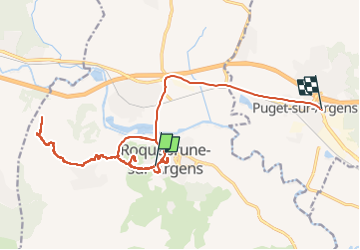
Trail Walking of 27 km to be discovered at Provence-Alpes-Côte d'Azur, Var, Roquebrune-sur-Argens. This trail is proposed by fab4u.
Positioning
Country:
France
Region :
Provence-Alpes-Côte d'Azur
Department/Province :
Var
Municipality :
Roquebrune-sur-Argens
Location:
Unknown
Start:(Dec)
Start:(UTM)
308448 ; 4812592 (32T) N.
Comments