


thelod

Nila81
User
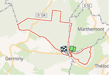

Length
10.8 km

Max alt
448 m

Uphill gradient
178 m
Km-Effort
13.2 km

Min alt
367 m

Downhill gradient
174 m
Boucle
Yes
Creation date :
2023-01-24 12:56:59.037
Updated on :
2023-01-24 15:44:37.677
2h46
Difficulty : Difficult

FREE GPS app for hiking
 SityTrail
IGN / Geographical institutes
SityTrail Plus
The world is yours!
About
Trail Walking of 10.8 km to be discovered at Grand Est, Meurthe-et-Moselle, Germiny. This trail is proposed by Nila81.
Positioning
Country:
France
Region :
Grand Est
Department/Province :
Meurthe-et-Moselle
Municipality :
Germiny
Location:
Unknown
Start:(Dec)
Start:(UTM)
280692 ; 5381685 (32U) N.
Comments