


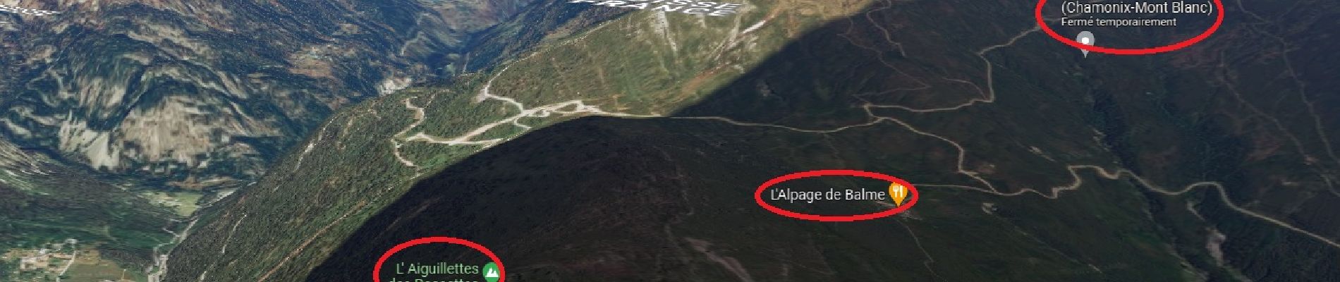
Col des Posettes, Aiguilles des Posettes, Alpage de Balme

Laurence Lallemand
User
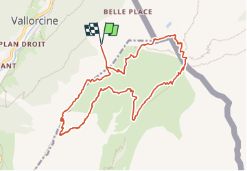

Length
10.8 km

Max alt
2313 m

Uphill gradient
694 m
Km-Effort
20 km

Min alt
1888 m

Downhill gradient
694 m
Boucle
Yes
Creation date :
2023-01-27 18:49:25.947
Updated on :
2023-01-27 19:03:54.131
1h58
Difficulty : Medium

FREE GPS app for hiking
 SityTrail
IGN / Geographical institutes
SityTrail Plus
The world is yours!
About
Trail Walking of 10.8 km to be discovered at Auvergne-Rhône-Alpes, Upper Savoy, Vallorcine. This trail is proposed by Laurence Lallemand.
Description
téléphérique Vallorcines/Posettes
Photos

Positioning
Country:
France
Region :
Auvergne-Rhône-Alpes
Department/Province :
Upper Savoy
Municipality :
Vallorcine
Location:
Unknown
Start:(Dec)
Start:(UTM)
341294 ; 5099394 (32T) N.
Comments