


Bretigny

werth
User
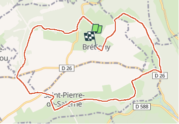

Length
12 km

Max alt
147 m

Uphill gradient
107 m
Km-Effort
13.4 km

Min alt
118 m

Downhill gradient
101 m
Boucle
No
Creation date :
2023-01-28 14:20:03.76
Updated on :
2023-01-31 11:28:44.291
2h52
Difficulty : Medium

FREE GPS app for hiking
 SityTrail
IGN / Geographical institutes
SityTrail Plus
The world is yours!
About
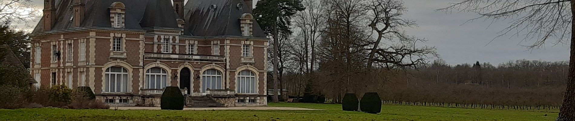
Trail Walking of 12 km to be discovered at Normandy, Eure, Brétigny. This trail is proposed by werth.
Photos

Positioning
Country:
France
Region :
Normandy
Department/Province :
Eure
Municipality :
Brétigny
Location:
Unknown
Start:(Dec)
Start:(UTM)
330479 ; 5453936 (31U) N.
Comments
