


Saint Maurice en haut des Côtes

kikkko
User
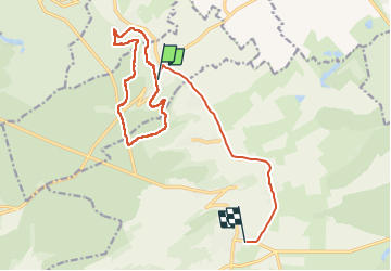

Length
15.3 km

Max alt
405 m

Uphill gradient
239 m
Km-Effort
18.5 km

Min alt
233 m

Downhill gradient
248 m
Boucle
No
Creation date :
2023-01-27 12:53:34.52
Updated on :
2023-02-01 07:21:55.926
2h41
Difficulty : Medium

FREE GPS app for hiking
 SityTrail
IGN / Geographical institutes
SityTrail Plus
The world is yours!
About
Trail Walking of 15.3 km to be discovered at Grand Est, Meuse, Saint-Maurice-sous-les-Côtes. This trail is proposed by kikkko.
Description
très jolis rando dans la forêt
Positioning
Country:
France
Region :
Grand Est
Department/Province :
Meuse
Municipality :
Saint-Maurice-sous-les-Côtes
Location:
Unknown
Start:(Dec)
Start:(UTM)
695835 ; 5432513 (31U) N.
Comments