


Rando Fertay Allais 21,5 km

jeanmarcMasson
User GUIDE
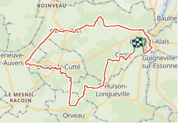

Length
21 km

Max alt
149 m

Uphill gradient
304 m
Km-Effort
25 km

Min alt
52 m

Downhill gradient
297 m
Boucle
No
Creation date :
2023-02-01 09:07:34.053
Updated on :
2023-02-01 14:50:05.32
4h35
Difficulty : Very difficult

FREE GPS app for hiking
 SityTrail
IGN / Geographical institutes
SityTrail Plus
The world is yours!
About
Trail Walking of 21 km to be discovered at Ile-de-France, Essonne, Cerny. This trail is proposed by jeanmarcMasson.
Positioning
Country:
France
Region :
Ile-de-France
Department/Province :
Essonne
Municipality :
Cerny
Location:
Unknown
Start:(Dec)
Start:(UTM)
450981 ; 5369534 (31U) N.
Comments