


Arbois Reculée des Planches

thonyc
User GUIDE
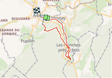

Length
12.2 km

Max alt
536 m

Uphill gradient
250 m
Km-Effort
16 km

Min alt
295 m

Downhill gradient
376 m
Boucle
No
Creation date :
2023-02-09 10:36:58.589
Updated on :
2023-02-12 11:01:51.963
4h10
Difficulty : Medium

FREE GPS app for hiking
 SityTrail
IGN / Geographical institutes
SityTrail Plus
The world is yours!
About
Trail Walking of 12.2 km to be discovered at Bourgogne-Franche-Comté, Jura, Arbois. This trail is proposed by thonyc.
Description
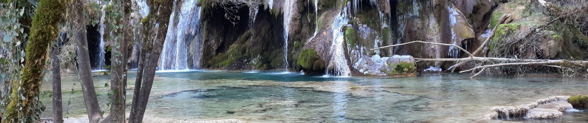
Jolie rando au départ d'Arbois, sentiers agréables, cascade de tufs et vasques d'eau remarquables. Ne pas hésiter à aller jusqu'au Fer à Cheval.
Photos


Positioning
Country:
France
Region :
Bourgogne-Franche-Comté
Department/Province :
Jura
Municipality :
Arbois
Location:
Unknown
Start:(Dec)
Start:(UTM)
711494 ; 5197368 (31T) N.
Comments