


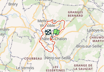
Château-Chalon boucle 11km

thonyc
User GUIDE

Length
11.3 km

Max alt
493 m

Uphill gradient
404 m
Km-Effort
16.7 km

Min alt
249 m

Downhill gradient
404 m
Boucle
Yes
Creation date :
2023-02-10 09:19:42.246
Updated on :
2023-02-11 16:47:40.336
5h00
Difficulty : Medium

FREE GPS app for hiking
 SityTrail
IGN / Geographical institutes
SityTrail Plus
The world is yours!
About
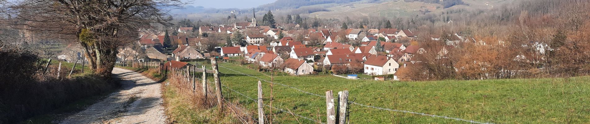
Trail Walking of 11.3 km to be discovered at Bourgogne-Franche-Comté, Jura, Château-Chalon. This trail is proposed by thonyc.
Description
Très jolie boucle avec des passages variés en bordure de plateau, puis dans la plaine par de jolis sentiers boisés et à travers les vignes.
A visiter: Château-Chalon, Ménétru, Voiteur, Névy.
Photos


Positioning
Country:
France
Region :
Bourgogne-Franche-Comté
Department/Province :
Jura
Municipality :
Château-Chalon
Location:
Unknown
Start:(Dec)
Start:(UTM)
700577 ; 5181265 (31T) N.
Comments