


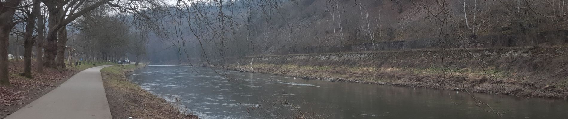
poulseur . la combe . chaply . fays . chanxhe . poulseur

stef789
User GUIDE
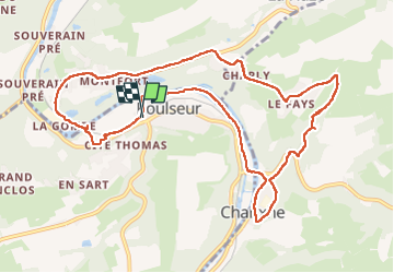

Length
10.7 km

Max alt
232 m

Uphill gradient
214 m
Km-Effort
13.5 km

Min alt
89 m

Downhill gradient
213 m
Boucle
Yes
Creation date :
2023-02-12 13:21:36.078
Updated on :
2023-02-12 16:24:51.743
3h02
Difficulty : Easy

FREE GPS app for hiking
 SityTrail
IGN / Geographical institutes
SityTrail Plus
The world is yours!
About
Trail Walking of 10.7 km to be discovered at Wallonia, Liège, Comblain-au-Pont. This trail is proposed by stef789.
Photos


Positioning
Country:
Belgium
Region :
Wallonia
Department/Province :
Liège
Municipality :
Comblain-au-Pont
Location:
Unknown
Start:(Dec)
Start:(UTM)
682790 ; 5598376 (31U) N.
Comments