


Le mont lachat

Jean-Marc C
User
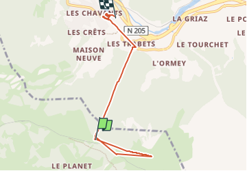

Length
6.1 km

Max alt
2099 m

Uphill gradient
323 m
Km-Effort
13.1 km

Min alt
984 m

Downhill gradient
1124 m
Boucle
No
Creation date :
2023-02-14 10:50:26.295
Updated on :
2023-02-14 16:09:43.918
4h10
Difficulty : Difficult

FREE GPS app for hiking
 SityTrail
IGN / Geographical institutes
SityTrail Plus
The world is yours!
About
Trail Walking of 6.1 km to be discovered at Auvergne-Rhône-Alpes, Upper Savoy, Saint-Gervais-les-Bains. This trail is proposed by Jean-Marc C.
Positioning
Country:
France
Region :
Auvergne-Rhône-Alpes
Department/Province :
Upper Savoy
Municipality :
Saint-Gervais-les-Bains
Location:
Unknown
Start:(Dec)
Start:(UTM)
327661 ; 5082396 (32T) N.
Comments