


Autour d'Eyguières

MarcLEBARON
User

Length
12.9 km

Max alt
306 m

Uphill gradient
433 m
Km-Effort
18.7 km

Min alt
89 m

Downhill gradient
435 m
Boucle
Yes
Creation date :
2023-02-17 08:14:38.362
Updated on :
2023-02-18 15:37:25.994
4h41
Difficulty : Difficult

FREE GPS app for hiking
 SityTrail
IGN / Geographical institutes
SityTrail Plus
The world is yours!
About
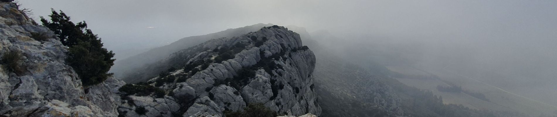
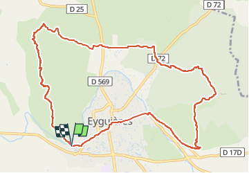
Trail Walking of 12.9 km to be discovered at Provence-Alpes-Côte d'Azur, Bouches-du-Rhône, Eyguières. This trail is proposed by MarcLEBARON.
Photos


Positioning
Country:
France
Region :
Provence-Alpes-Côte d'Azur
Department/Province :
Bouches-du-Rhône
Municipality :
Eyguières
Location:
Unknown
Start:(Dec)
Start:(UTM)
662823 ; 4839502 (31T) N.
Comments