Trail Walking Tende - 
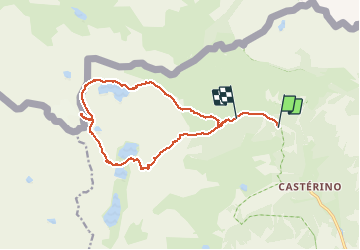
Cime Cossato en boucle - Photo
© OpenStreetMap contributors
Length
Length
17.5 km
Max alt
Max alt
2834 m
Uphill gradient
Uphill gradient
1197 m
Km-Effort
Km-Effort  
33 km
Min alt
Min alt
1725 m
Downhill gradient
Downhill gradient
1115 m
Boucle
Boucle
No
Creation date :
2014-12-10 00:00:00.0
Updated on :
2014-12-10 00:00:00.0

(0 Reviews)

Walking
Walking
7h30
Difficulty : Difficult

Scan this QR Code to open this trail in the SityTrail application

FREE GPS app for hiking

Logo SityTrail SityTrail

IGN / Geographical institutes

Download SityTrail from the App Store Download SityTrail from Google Play

Logo SityTrail SityTrail Plus

The world is yours!

Download SityTrail from the App Store Download SityTrail from Google Play Download SityTrail on Huawei AppGallery

About

Trail Walking of 17.5 km to be discovered at Provence-Alpes-Côte d'Azur, Maritime Alps, Tende. This trail is proposed by PEBREJOSIANE.

Description

Départ de l'entrée du Parc.
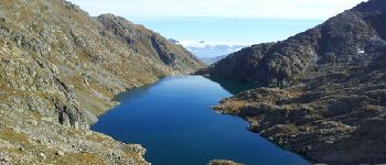
Montée par le lac et le pas de l'Agnel
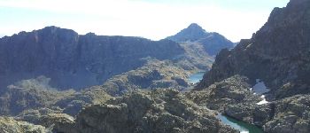
Collet de la Charnassière..Cime Cossato
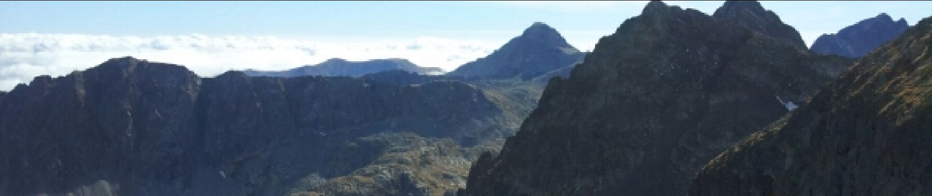
Vues superbes sur les lacs gelés, Valmasque, Noir, Agnel..sur le Mont Rose, la Corse, les Ecrins...le Bégo...le clapier
Descente par les lacs gelés puis la Valmasque.
Compter 18.5km l'enregistrement s'est arrêté 1 km avant le retour aux voitures

Elevation profile

Photos

Points of interest

Point of interest Tende - Point 1 - Photo
PEBREJOSIANE
TENDE 
Point of interest Tende - Point 4 - Photo
PEBREJOSIANE
TENDE 

Positioning

Country:
France
Region :
Provence-Alpes-Côte d'Azur
Department/Province :
Maritime Alps
Municipality :
Tende
Location:
Unknown
Start:(UTM)
379593 ; 4885567 (32T) N.


Close
My subscriptions