


Vernon Tour de Brison 20km

thonyc
User GUIDE
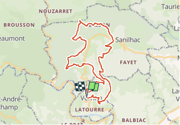

Length
19.9 km

Max alt
775 m

Uphill gradient
668 m
Km-Effort
29 km

Min alt
298 m

Downhill gradient
671 m
Boucle
Yes
Creation date :
2023-02-19 08:34:22.391
Updated on :
2023-02-27 13:54:07.896
6h00
Difficulty : Difficult

FREE GPS app for hiking
 SityTrail
IGN / Geographical institutes
SityTrail Plus
The world is yours!
About
Trail Walking of 19.9 km to be discovered at Auvergne-Rhône-Alpes, Ardèche, Vernon. This trail is proposed by thonyc.
Description
Joli village avec des hameaux espacés, de beaux points de vue sur les terrasses très bien entretenues, des sentiers variés avec une géologie diverse.
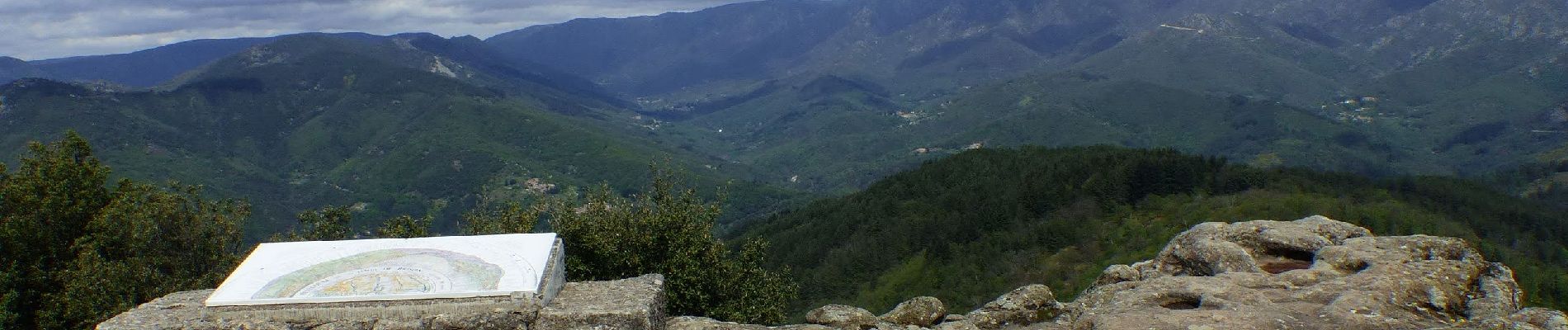
la Tour de Brison avec son panorama à 360°.
Photos


Positioning
Country:
France
Region :
Auvergne-Rhône-Alpes
Department/Province :
Ardèche
Municipality :
Vernon
Location:
Unknown
Start:(Dec)
Start:(UTM)
597099 ; 4929003 (31T) N.
Comments