


Cime d'Anan depuis Saorge

aris
User
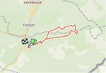

Length
15.2 km

Max alt
1785 m

Uphill gradient
1329 m
Km-Effort
33 km

Min alt
478 m

Downhill gradient
1328 m
Boucle
Yes
Creation date :
2023-02-19 07:47:01.021
Updated on :
2023-02-20 16:08:14.515
8h15
Difficulty : Difficult

FREE GPS app for hiking
 SityTrail
IGN / Geographical institutes
SityTrail Plus
The world is yours!
About
Trail Walking of 15.2 km to be discovered at Provence-Alpes-Côte d'Azur, Maritime Alps, Saorge. This trail is proposed by aris.
Description
Hors sentier entre la baisse d'Anan et la cime (parcours à vue). Hors sentier également en lisière de forêt en début de descente jusqu'à la fontaine des Chiens (borne 204).
Positioning
Country:
France
Region :
Provence-Alpes-Côte d'Azur
Department/Province :
Maritime Alps
Municipality :
Saorge
Location:
Unknown
Start:(Dec)
Start:(UTM)
384097 ; 4870991 (32T) N.
Comments