


2023-02-24_09h14m57_Gour de la sompe Circuit à partir de Lagorce

Linerou
User
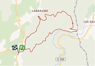

Length
11 km

Max alt
300 m

Uphill gradient
303 m
Km-Effort
15.1 km

Min alt
163 m

Downhill gradient
303 m
Boucle
Yes
Creation date :
2023-02-24 08:14:58.037
Updated on :
2023-02-27 13:15:25.705
3h25
Difficulty : Medium

FREE GPS app for hiking
 SityTrail
IGN / Geographical institutes
SityTrail Plus
The world is yours!
About
Trail Walking of 11 km to be discovered at Auvergne-Rhône-Alpes, Ardèche, Lagorce. This trail is proposed by Linerou.
Positioning
Country:
France
Region :
Auvergne-Rhône-Alpes
Department/Province :
Ardèche
Municipality :
Lagorce
Location:
Unknown
Start:(Dec)
Start:(UTM)
612639 ; 4923771 (31T) N.
Comments