


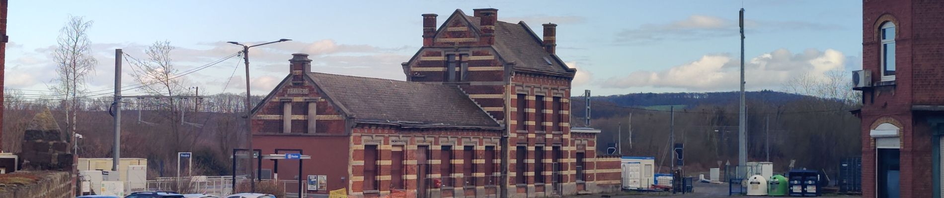
Franière - Floreffe - Malonne

flouzer
User
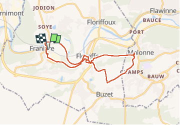

Length
13.8 km

Max alt
203 m

Uphill gradient
279 m
Km-Effort
17.5 km

Min alt
80 m

Downhill gradient
278 m
Boucle
Yes
Creation date :
2023-02-25 10:47:12.104
Updated on :
2023-02-25 14:04:21.442
3h16
Difficulty : Easy

FREE GPS app for hiking
 SityTrail
IGN / Geographical institutes
SityTrail Plus
The world is yours!
About
Trail Walking of 13.8 km to be discovered at Wallonia, Namur, Floreffe. This trail is proposed by flouzer.
Photos


Positioning
Country:
Belgium
Region :
Wallonia
Department/Province :
Namur
Municipality :
Floreffe
Location:
Franière
Start:(Dec)
Start:(UTM)
623098 ; 5588916 (31U) N.
Comments