


Grane-Les Roberts 13km

thonyc
User GUIDE
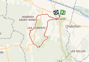

Length
13.1 km

Max alt
412 m

Uphill gradient
332 m
Km-Effort
17.5 km

Min alt
153 m

Downhill gradient
331 m
Boucle
Yes
Creation date :
2023-02-26 12:18:44.18
Updated on :
2023-02-26 17:57:16.363
3h30
Difficulty : Easy

FREE GPS app for hiking
 SityTrail
IGN / Geographical institutes
SityTrail Plus
The world is yours!
About
Trail Walking of 13.1 km to be discovered at Auvergne-Rhône-Alpes, Drôme, Grane. This trail is proposed by thonyc.
Description
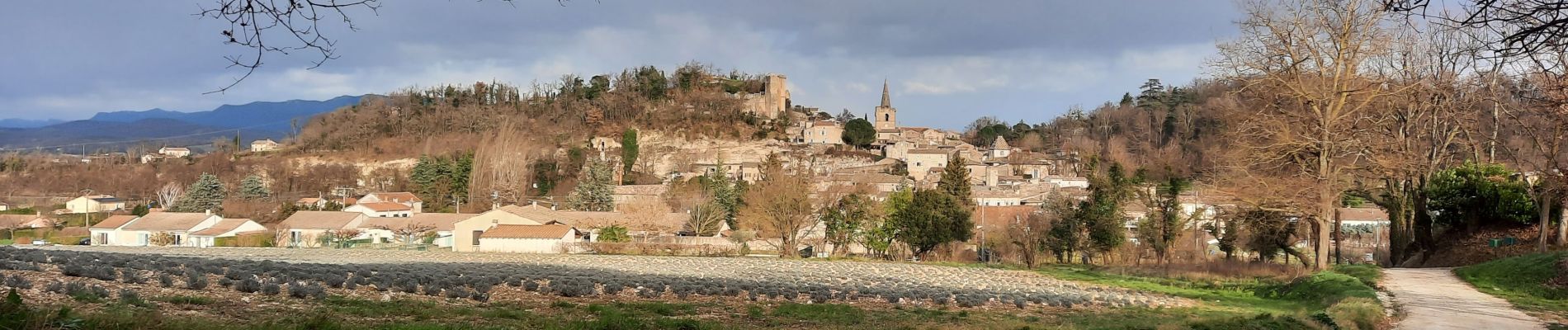
Arpenter le village de Grane.
De jolis panoramas sur toute la vallées et sur les montagnes de la Drôme.
Photos


Positioning
Country:
France
Region :
Auvergne-Rhône-Alpes
Department/Province :
Drôme
Municipality :
Grane
Location:
Unknown
Start:(Dec)
Start:(UTM)
652383 ; 4954981 (31T) N.
Comments