


boucle pour allez au chalet prey perret

olivier26
User
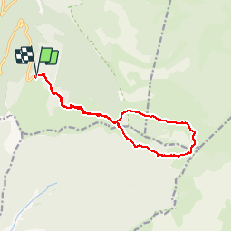

Length
13.9 km

Max alt
1669 m

Uphill gradient
668 m
Km-Effort
23 km

Min alt
1379 m

Downhill gradient
669 m
Boucle
Yes
Creation date :
2014-12-10 00:00:00.0
Updated on :
2014-12-10 00:00:00.0
3h51
Difficulty : Medium

FREE GPS app for hiking
 SityTrail
IGN / Geographical institutes
SityTrail Plus
The world is yours!
About
Trail Walking of 13.9 km to be discovered at Auvergne-Rhône-Alpes, Drôme, Saint-Agnan-en-Vercors. This trail is proposed by olivier26.
Description
magnifique rando en plaine de prairie puis sous bois en foret....retour facile par la prairie d'herbe jusqu'au parking
Positioning
Country:
France
Region :
Auvergne-Rhône-Alpes
Department/Province :
Drôme
Municipality :
Saint-Agnan-en-Vercors
Location:
Unknown
Start:(Dec)
Start:(UTM)
691481 ; 4968280 (31T) N.
Comments