tour de chamoise

tgvpatrickfavre
User

Length
13.6 km

Max alt
1123 m

Uphill gradient
767 m
Km-Effort
24 km

Min alt
480 m

Downhill gradient
767 m
Boucle
Yes
Creation date :
2014-12-10 00:00:00.0
Updated on :
2014-12-10 00:00:00.0
3h32
Difficulty : Medium

FREE GPS app for hiking
 SityTrail
IGN / Geographical institutes
SityTrail Plus
The world is yours!
About
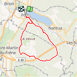
Trail Walking of 13.6 km to be discovered at Auvergne-Rhône-Alpes, Ain, Port. This trail is proposed by tgvpatrickfavre.
Description
depuis port les monts d ain en boucle
Positioning
Country:
France
Region :
Auvergne-Rhône-Alpes
Department/Province :
Ain
Municipality :
Port
Location:
Unknown
Start:(Dec)
Start:(UTM)
698581 ; 5115382 (31T) N.
Comments