


l'AIGUILLETTE- (le petit VEYMONT)

okfred26
User

Length
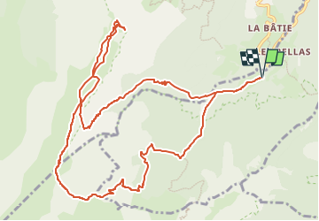
14.1 km

Max alt
2100 m

Uphill gradient
1100 m
Km-Effort
29 km

Min alt
1131 m

Downhill gradient
1100 m
Boucle
Yes
Creation date :
2023-03-06 10:35:58.593
Updated on :
2023-03-06 10:38:30.239
6h32
Difficulty : Very difficult

FREE GPS app for hiking
 SityTrail
IGN / Geographical institutes
SityTrail Plus
The world is yours!
About
Trail Walking of 14.1 km to be discovered at Auvergne-Rhône-Alpes, Isère, Saint-Michel-les-Portes. This trail is proposed by okfred26.
Positioning
Country:
France
Region :
Auvergne-Rhône-Alpes
Department/Province :
Isère
Municipality :
Saint-Michel-les-Portes
Location:
Unknown
Start:(Dec)
Start:(UTM)
702069 ; 4970373 (31T) N.
Comments