


Montélimar Aleyrac 60km

thonyc
User GUIDE
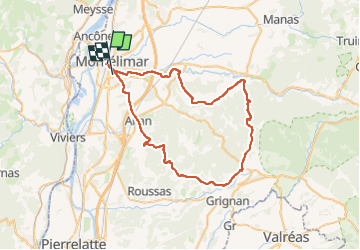

Length
60 km

Max alt
485 m

Uphill gradient
839 m
Km-Effort
71 km

Min alt
80 m

Downhill gradient
827 m
Boucle
No
Creation date :
2023-03-09 12:36:14.51
Updated on :
2023-03-22 06:57:02.196
4h02
Difficulty : Medium

FREE GPS app for hiking
 SityTrail
IGN / Geographical institutes
SityTrail Plus
The world is yours!
About
Trail Road bike of 60 km to be discovered at Auvergne-Rhône-Alpes, Drôme, Montélimar. This trail is proposed by thonyc.
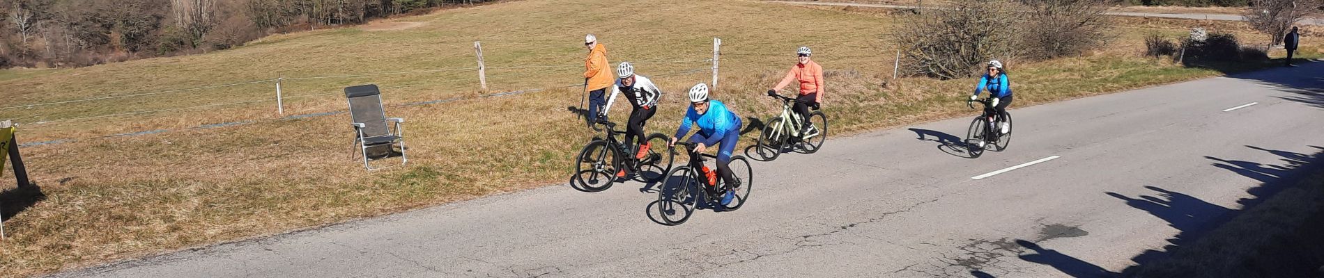
Photos

Positioning
Country:
France
Region :
Auvergne-Rhône-Alpes
Department/Province :
Drôme
Municipality :
Montélimar
Location:
Unknown
Start:(Dec)
Start:(UTM)
638544 ; 4934951 (31T) N.
Comments